Elevation Data
All of the Estonian territory is covered by LiDAR collected elevation data. For the first two rounds, scanning was done by Leica ALS50-II scanner at altitude 2400m. The third and fourth round with Riegl VQ-1560i scanner and at altitude 2000m or 2600m. In addition, low altitude (1200m) data was collected about densely populated areas. There were also summertime flights for forestry purposes covering 1/4 of the territory each year collected appox at 3000m altitude.
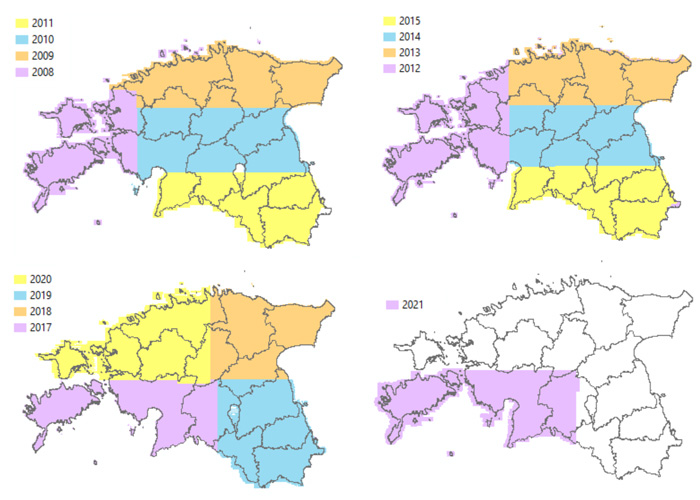
Schema 1. Springtime ALS data by year (at altitude 2400-2600m)
Raw LiDAR material is in LAZ 1.4 format.
Each LAZ file covers 1 km2 and the classification has been made automatically. Possible class values are:
1 - Unclassified
2 - Terrain (including flagged keypoints)
5 - First and middle reflections (mostly trees/ bushes)
6 - Buildings (points which fall inside the buildings layer of Estonian Topographic Database, starting from the year 2012 data )
7 - Noise (below terrain)
9 - Water (points which fall inside the water layer of Estonian Topographic Database, starting from the year 2012 data)
17 - Terrain under bridges (overlap bit)
18 - Noise (above terrain)
Digital elevation models are in GeoTIFF or XYZ ASCII format. DEMs include DTM (grid sizes 1m, 5m, 10m, 25m) , DSM (grid sizes 1m, 5m), nDSM (grid sizes 1m, 5m) and CHM models (grid sizes 4m, 10m). Latest DEM's are made from 2021-2024 ALS data. DTM is made of springtime flight data (including low altitude flights above towns), DSM's nad CHM's are made of both springtime and summertime flight data.
There are also elevation lines (2.5m interval) and related elevation points bundled into Estonian Basic Map vector dataset.
All the elevation data is in EH2000 height system (EVRS - European Vertical Reference System), based on NAP (Normaal Amsterdams Peil). The closest vertical EPSG code is 5621. Horisontal reference system is EPSG:3301
Data is licenced under Open Data License (click for full text)
Please refer to the source of origin and date when using the data. For example:
Elevation data 2021-2024, Republic of Estonia Land and Spatial Development Board