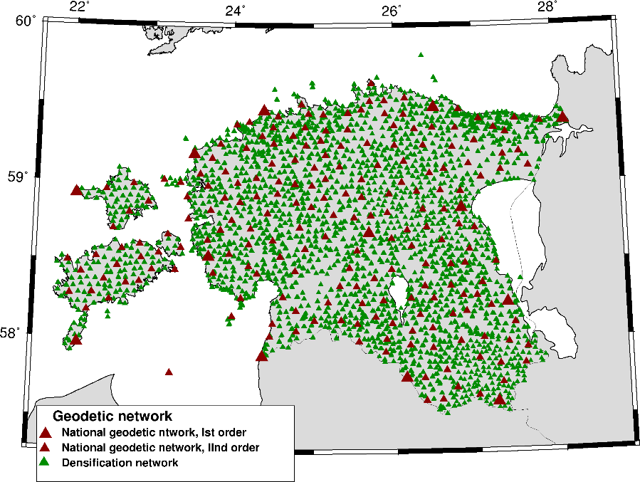
Geodetic Networks
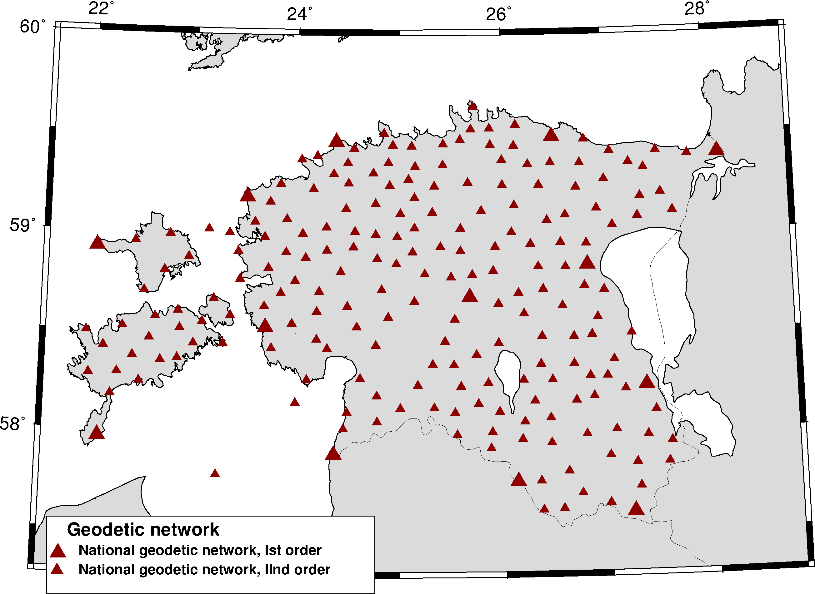
National Geodetic Network
The National Geodetic Network has been measured using GPS technology and is divided into classes according to the Estonian Geodetic System as follows: first order network, second order network and densification network.
The National Geodetic Network is based on ITRF96 reference frame points. The density of the first and second order network points is 1 point per 225 km², and it serves as basis for the densification network. The first order network consists of 13 points with the distance between points being 70-110 km. The average accuracy is ± 1 cm and the relative error is 1: 7 000 000. The second order network consists of 199 points. The points are homogenously distributed throughout Estonia at an average spacing of 15 km. The average accuracy is ± 1 cm and the relative error is 1: 500 000. By the IAG Sub-Commission EUREF (Prague 1999), the National Geodetic Network is considered to meet the requirements of the European Reference Frame Class B and is the EUREF densification network in Estonia (EUREF-EST97).
Densification Network
The densification network was created gradually in 1992-2001. The densification network consists of 3922 points (mostly point pairs), the density of points being one point pair per 16-25 km² (with an average spacing of 5 km), the distance of points in pairs being 500 m. GPS measurement technology was used (relative static method, session duration 90-210 minutes).
The average accuracy of the densification network is ± 1 ... 3 cm and the relative error is 1: 250 000. The final network consists of 15 692 GPS vectors and was adjusted in two parts: the mainland of Estonia and the islands of Western Estonia. The adjustment of the densification network is based on the points of the first and second order geodetic networks.