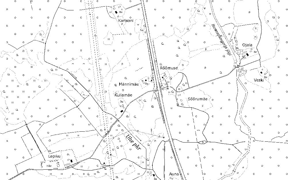
Estonian Basic Map 1:10 000
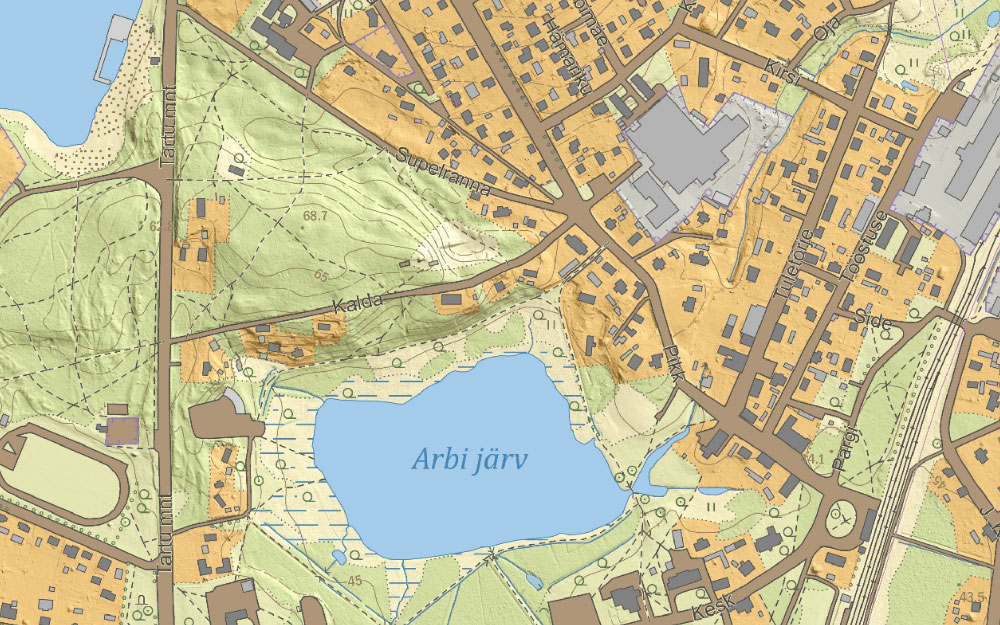
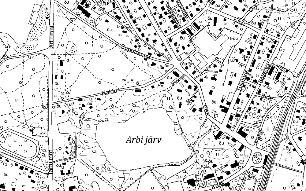
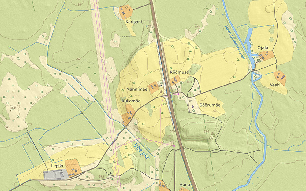
The Estonian basic map is a seamless digital topographic database with a nationwide coverage. It contains information on utilities (roads, electric power lines, etc.), settlement, hydrography, place names and land use. The accuracy and content corresponds to the mapping scale of 1:5000- 1:10 000. The used projection is L-EST97 (epsg:3301). The map is based on the core Estonian Topographic Database (having certain data extraction timestamp somewhere in november in each year).
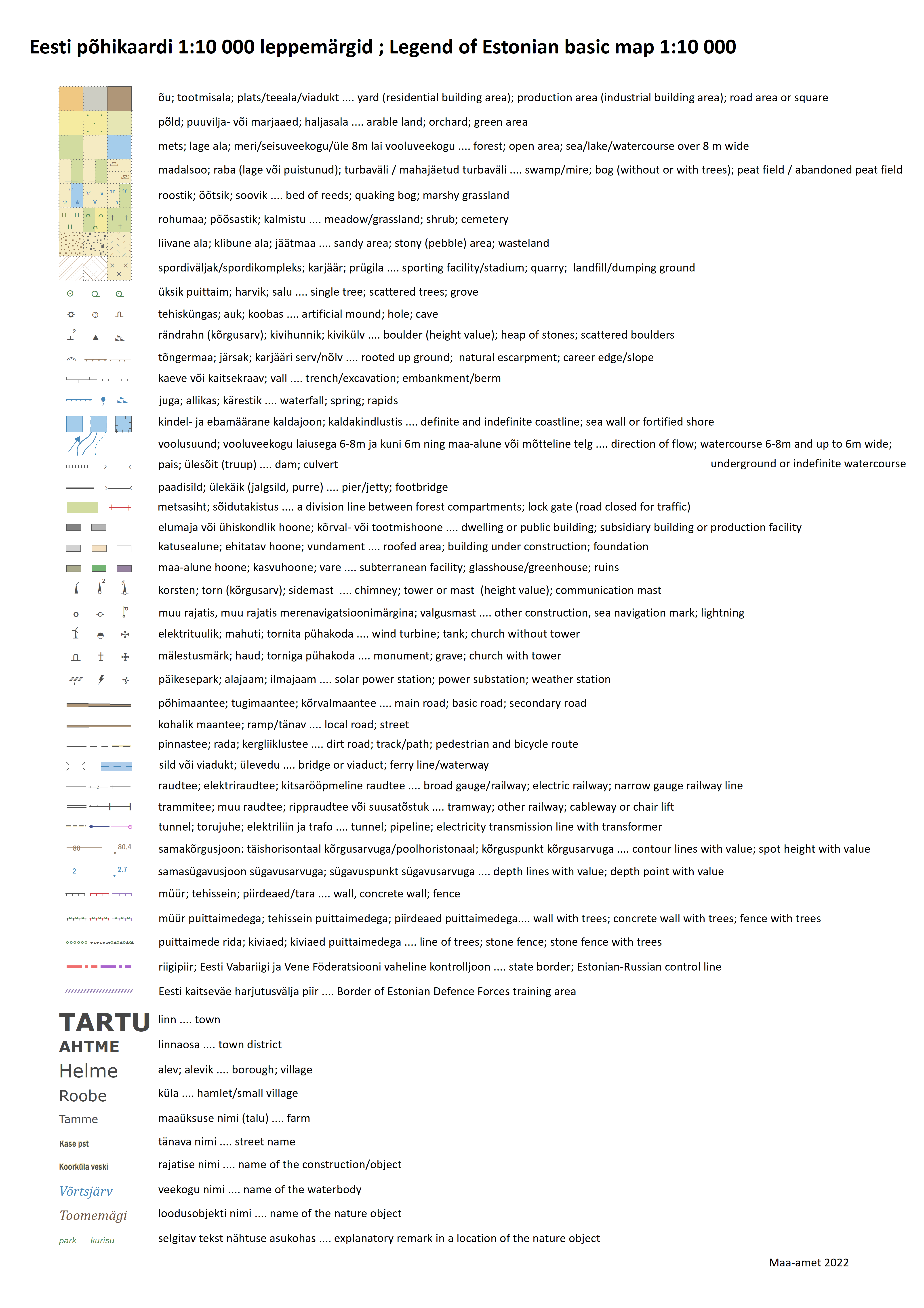
- Legend of Estonian Basic Map (Estonian/English) ( 608 KB, 15.10.2025)
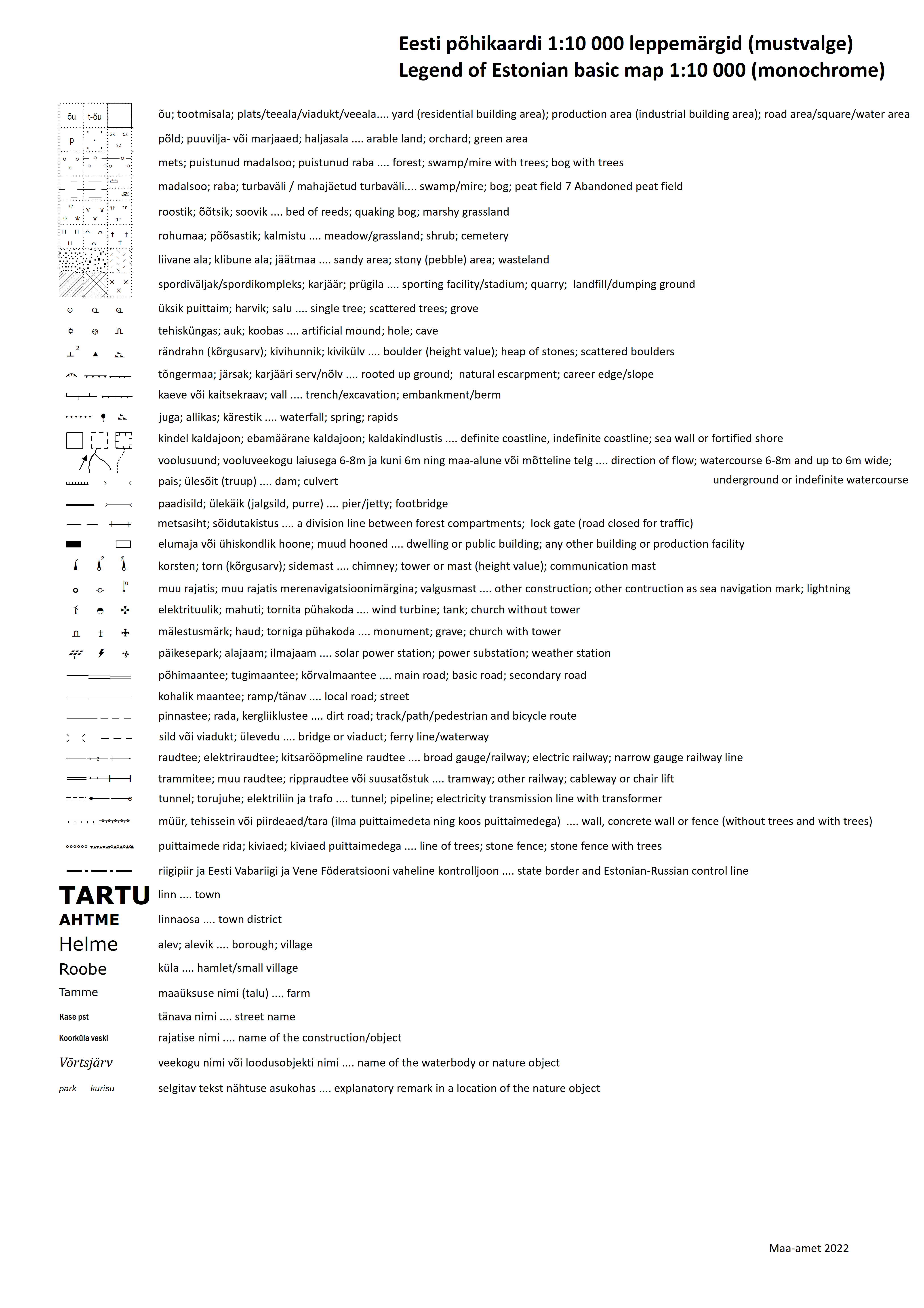
- Legend of monochrome Estonian Basic Map raster (Estonian/English) ( 522.6 KB, 15.10.2025)
| Map properties | |
|---|---|
| Format | color map with relief shading, color map, monochrome map in GeoTIFF, ESRI SHP or MapInfo TAB vector datasets |
| Data structure | raster and vector |
| Scale | 1:10 000 |
| Update frequency | annually (whole territory at once, usually published in the very beginning of each year) |
| Licence | Open Data License Please refer to the source of origin and date when using the data. For example: "Estonian basic map 2026: Republic of Estonia Land and Spatial Development Board" |
The map has several outputs: a vector map, a colored raster map (with or without hillshade) and a monochrome raster map.
How to use
Legend