ESTPOS - national GNSS satellite data center
ESTPOS reference station network consists of 40 GNSS reference stations evenly covering Estonia. ESTPOS network is necessary for the monitoring of the Estonian geodetic reference system and its components (coordinates and their velocities). In addition, ESTPOS ensures accessibility to precise location-based information throughout Estonia and also supports real-time GNSS measurements with an accuracy of 2-5 cm.
The short-term (last 90 days) observation data of ESTPOS reference stations are available via ESTPOS user portal. Older observation data are archived in the Land and Spatial Development Board and can be made available to the users based on their needs. In addition to downloading the observation data of ESTPOS reference stations it is also possible to do GNSS computations and coordinate transformations in the ESTPOS user portal. Access to ESTPOS real-time correction data is also made available through the ESTPOS user portal.
Based on the order 1-17/26/131 of the director general of the Land and Spatial Development Board, ESTPOS service "RTCM striimid" is free to use for anyone until 31.08.2026. To use the service a ESTPOS user portal account must be created, desired ESTPOS service must be ordered in the ESTPOS user portal shop and the ESTPOS contract must be signed. After ESTPOS user support has received the signed contract, access to selected ESTPOS service will be made available to the user.
ESTPOS GNSS reference stations and their data are involved in many international projects. Four ESTPOS GNSS reference stations belong to the EPN (EUREF Permanent GNSS Network) and all ESTPOS reference stations to the EPOS (European Plate Observing System) network. The data of ESTPOS GNSS reference stations are used in the working groups of NKG (Nordic Geodetic Commission) and EUREF (Reference Frame Sub Commission for Europe).
The reconstruction of the national GNSS satellite data center took place in 2024-2025 and was funded by the European Union – NextGenerationEU.
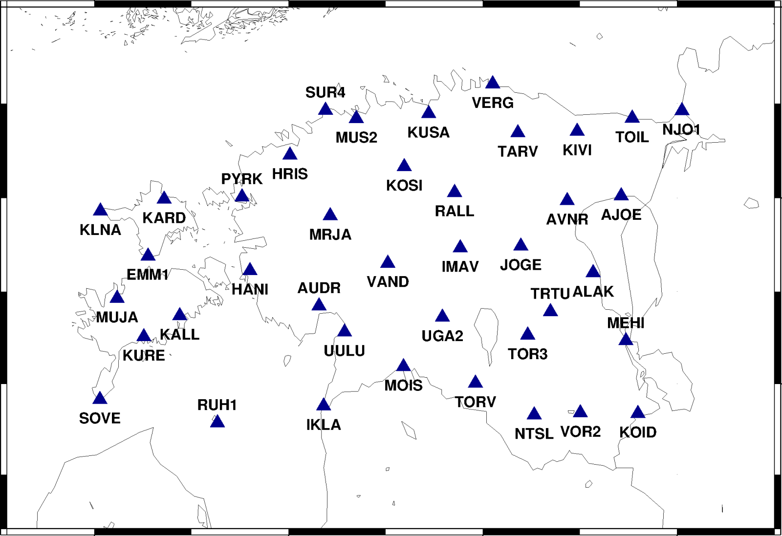
ESTPOS GNSS reference station network.
 Access to data
Order 1-17/26/131
- ESTPOS order ( 145.5 KB, 09.02.2026)
ESTPOS contract
- ESTPOS contract ( 188.7 KB, 09.02.2026)
ESTPOS user manual
- ESTPOS user manual ( 2.8 MB, 12.03.2026)